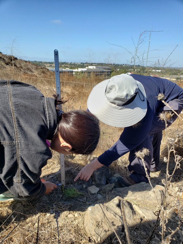
Our program’s capstone experience is a team-based project focused on a community-engaged collaboration extending across the program’s second year.
During their second year, students are required to complete 12 units of a group capstone project. Groups of students (3-6) will complete a project involving a local partner/stakeholder and organized by CEB to address a current environmental problem, giving the students an opportunity to work directly with practitioners to design, develop, conduct, and implement a project. Group projects must be:
- Solution oriented – Projects should yield specific policy or management recommendations, contain multidisciplinary elements, and align with student and partner interests.
- Framed by Active Adaptive Management – Group project will be nested within an active adaptive management framework and will include a review of literature and analysis of data.
Capstone projects will produce a written document and be presented to the broader community of conservation and restoration science professionals in southern California at an annual workshop in the Spring.
2022-23 Capstone Projects:
Click each project for detailed descriptions:
Beach Wrack Ecology and Monitoring
Beach wrack (kelp and other macrophyte debris deposited on shores) is a key source of nutrients for beach communities, and its presence increases the diversity and abundance of invertebrates and shorebirds, including threatened species. In 2021-2022, an MCRS Capstone team established survey methods and a monitoring protocol for Crystal Cove State Park to track shifts in this important resource and inform decisions about management and restoration. In addition, the team has developed with Crystal Cove Conservancy an educational module for community science data collection on wrack by middle school to college students. This team has also piloted invertebrate biodiversity surveys in collaboration with the Museum of Natural History of Los Angeles. The capstone team for 2022-2023 will build on this foundation of work to continue to study and promote the education of the public about this ecosystem through several of the following possible project directions:
-
- Field work: a collection of monthly monitoring data on wrack ecology, biomass, distribution, seasonality, and composition of wrack, and extending surveys to include manipulative experiments testing rates of consumption, decomposition, and desiccation rates of common wrack species.
- Implementation of the educational curriculum and community science components of the monitoring program, including promotion to schools and building out educational and promotional resources on Crystal Cove Conservancy’s website through the Environmental Challenges Program.
- Invertebrate biodiversity surveys and analysis of DNA barcoding data on wrack invertebrates to determine prevalence of rare and endemic species in the park and put in the context of regional metapopulations of wrack specialist species.
- Shorebirds: students have access to long-term datasets (and may participate in data collection) on shorebird surveys and nest monitoring at state beaches throughout California to assess differences between groomed and ungroomed beaches.
Impacts of Global Change
Rainfall has become increasingly variable due to global climate change. How resilient are local plant communities to increases or decreases in water and nutrient availability? This capstone project will focus on the Loma Ridge Global Change Experiment, in which rainfall and nitrogen have been experimentally manipulated since 2007. The capstone team will collect physiological trait measurements on plants within the plots and analyze long-term plant community data to evaluate connections between plant traits and response to global change. Additional analyses could focus on community response to “relaxing” half of the treatments for a period of several years and on community response following wildfire. There are opportunities to collaborate with the team of microbial scientists who work on the plots, perhaps investigating plant-microbe feedbacks in response to the global change manipulations.
Restoring Healthy Habitats
The goal of this project is to evaluate the effectiveness of restoration for providing healthy habitats. How do the native plants interact with weather conditions to influence insect and bird communities at Crystal Cove State Park? How can data collected in the past be used to determine optimal future restoration as part of the adaptive management process? One goal of restoration is to increase habitat health for multiple trophic levels, yet measurements are rarely conducted beyond the plant community. The initial objective is to assemble a diverse native community that is resilient to future stressors such as invasion by non-native species and drought. Current objectives are to utilize approaches that address known uncertainty in weather patterns in southern California and guide future management decisions on how to achieve different levels of ecological diversity, stability, and function.
This project is a collaboration between the Center for Environmental Biology, Crystal Cove State Park, and the Crystal Cove Conservancy. The aims of the project are to identify best practices for restoring native coastal sage scrub and California prairie habitat through an ecological restoration experiment. Specifically, the experiment will allow us to: (1) compare the effects of restoration of coastal sage scrub versus California prairie on ecosystem processes such as water and nutrient cycling and biodiversity; (2) measure the minimum required maintenance efforts for California prairie community persistence; (3) clarify the role of inter-annual variation in precipitation on restoration techniques; and (4) identify the types of species that will be most sustainable in a restored coastal sage scrub community. The project is entering its fifth year. The MCRS capstone project will focus on analyzing existing data, collecting any new data necessary to fill in knowledge gaps, and making management recommendations for the site based on results.
Sources of Marine Debris and Gill Nets and Entanglement Impacts On Marine Mammals
Entanglement in gill nets and other marine debris is a major cause of mortality in marine mammals, sharks, and other large-bodied marine animals, including endangered and protected species. Gill nets are large fishing nets made of clear mesh designed with holes large enough for a fish’s head to pass through, but not the body, entangling the gills. Entanglement can prevent proper feeding, constrict growth, cause infection, drown entangled animals, or cause extreme fatigue as animals carry them for miles during migration and foraging. While the United States and California have many policies regulating the use of gill nets and mandating technologies to reduce bycatch, gill nets remain a large source of mortality and injury. Over 200 marine mammals were incidentally recorded as killed by gill nets between 2014 and 2018, likely a substantial undercount. Locally, the animal rescue team at Pacific Marine Mammal Center (PMMC) have observed concerning increases; six gillnet-entangled sea lions were rescued in Orange County in April 2021 alone.
While NOAA collects information on entanglements by species and fishery gear type, the scope of the problem is not well understood, and an assessment of impacts in southern California or Orange County is needed. This project proposes to aid in adaptive management of marine mammals by examining prevalence and sources of gillnets (and potentially other fishing gear) leading to entanglement in marine mammals through one or more (based on student interest and feasibility) of the following potential project directions:
- What is the prevalence of sea lion gill net entanglement? Students will conduct field surveys and analyze camera data to identify and count entangled sea lions at Dana Point Harbor/Marina.
- Are marine mammal entanglements seasonal? Students may analyze NOAA entanglement records for the southern California region for demographics, seasonality, locations, impacts, and debris type.
- Which fisheries are active at the time of year with the most entanglements, and does the type of gear involved in recorded entanglements match the probable fishery? Students may analyze archived entanglement material at PMMC or NOAA records.
- Possible Extensions:
- Policy analysis: Many existing policies regulate the use of gillnets; students would research and summarize existing policy, enforcement and efficacy, and write an evaluation of current and proposed future policies.
Science communication: Results of this study may be developed into educational curricula to be used by docents and educators at the Pacific Marine Mammal Center to educate adults and children about more sustainable fishery methods.
White-tailed Kites Conservation
Local records indicate White-tailed Kites (WTKI) have consistently foraged and nested within open space areas on the University of California Irvine for over 50 years. Unfortunately, the activity and number of nesting pairs have declined dramatically, particularly the last couple decades, both on UC property and in the region more generally. Observations the last several years indicate that the University property is one of only a few remaining areas in Orange County where kites are nesting. Open space lands within UC Irvine include lands enrolled in the central-coastal Orange County Natural Communities Conservation Plan and within the UC Natural Reserve System. To maintain existing nesting pairs, and hopefully encourage additional pairs in the future, the University would like to support research that will inform management recommendations for an Interim White-tailed Kite Management Plan for the campus and immediate vicinity. To understand possible causes and the extent and intensity of decline, a thorough summary of historic data is necessary. This summary could facilitate subsequent visits to former territories and provide context for the campus populations relative to others in the region. In addition to a summary of historic data in the region, study will summarize knowledge gaps and conduct field studies to gather necessary information to guide future management actions. The capstone group will work with UCI Nature staff, consultants, and volunteers on the White-tailed kite study and development management recommendations. Key questions and tasks, roles, and estimated costs of the capstone group are identified below.
- Understand population trends & status based on summaries of existing data.
- Identify data gaps
- Determine habitat use & monitor birds
- Use incidental and trained volunteer observations to assess habitat use in reserves and county (if enough data)
- Assist in fitting transmitters to adult birds and in reviewing data and creating a GIS database.
- Evaluate habitat correlates- vegetation type, water access,
- Monitor existing nests & assess territory status
- Monitor campus nests
- Revisit historical nesting territories to determine status
- Assist in writing final report & management recommendations
Students will gain experience with bird observation, nest monitoring, GIS, working with volunteers (through citizen science) to collect data, and possibly working with transmitters and potentially small mammal trapping. The complexities of urban wildlife conservation will also be highlighted.
2023-24 Capstone Projects:
Click each project for detailed descriptions:
Estuarine Condition Assessment in Southern California Bight
The Southern California Bight Regional Monitoring Program is an ongoing marine monitoring collaboration that examines how human activities have affected the health of more than 1,500 square miles of Southern California’s coastal waters, from Point Conception to Tijuana. Via this partnership that is facilitated by SCCWRP, dozens of participating organizations pool their resources and expertise to investigate the condition of marine ecosystems across both time and space. Both regulated and regulatory agencies, as well as nongovernmental and academic organizations, come together to design studies, interpret findings, and speak with a common voice about the ecological health of the Southern California Bight.
This capstone project will work with Dr. Eric Stein and Dr. Jan Walker to assess one or more conditions of Southern California’s low-lying coastal estuaries, with a goal to understand how their ecological functioning has been adversely affected by human activities and how resilient they will be in the face of future climate change. Metrics a capstone project could focus on, depending on student interests:
- Abiotic factors such as water quality (climatic conditions, turbidity, TSS), water level, sediment contamination, nutrients, or grain size, mouth and freshwater dynamics, trash/microplastics.
- Biotic factors such as benthic infauna, fish communities, vegetation composition/biomass/cover, macroalgae, coastal and targeted bird surveys, invertebrates/epifauna, and eDNA.
- Landscape factors such as sediment accretion and elevation, relative habitat composition/habitat type, physical disturbance, and CRAM.
Field data collection will take place primarily in the Fall and will be coordinated with SCCWRP staff. Team members will collect data with SCCWRP teams and gain experience with and contribute to more datasets than will be examined for their project. Winter and Spring will focus on data analysis for capstone research questions using the compiled SoCal Bight Data. A possible extension would bring in additional partners to focus on education and outreach about plastic pollution.
Mesquite Bosque Health and Groundwater Availability
Groves of mesquite trees, also referred to by the Spanish term “mesquite bosques,” construct a biodiversity hotspot that sustains a unique collection of plant, insect, reptile, bird, and mammal species in the drylands of the southwestern U.S. Importantly, mesquite are facultative phreatophytes meaning that they have roots that extend to the water table as well as more shallow roots that take advantage of surface water. Because mesquite can use groundwater, they are an important consideration in any Groundwater Sustainability Plan (GSP). Due to a 2015 law, the Sustainable Groundwater Management Act, any basin in California that extracts more groundwater than is replenished is considered critically overdrafted and must create a GSP that lays out how the basin will ramp down its water use over the next 20 years. All users of groundwater, including plants, must be included to get an accurate assessment of groundwater use and, therefore, determine how much farmers, golf courses, and community members will need to decrease their water use.
In Borrego Springs, a community located within the boundaries of Anza-Borrego Desert State Park in eastern San Diego County, mesquite is not included in their GSP because it is argued that the mesquite can no longer reach groundwater. Though groundwater has declined by over 50 feet in some parts of the mesquite bosque, mesquite is one of the deepest-rooted plants in the world. This capstone project aims to prove that the mesquite bosque in Borrego Springs is healthy and functioning and that it should be included in the GSP. As an important part of that goal, we will assess the flora and fauna of the mesquite bosque using wildlife cameras, floristic surveys, and searches of existing databases. The findings will be written up in a brief technical report and developed into K-12 educational materials.
Project components, depending on the interest of student participants, may include:
-
- Fieldwork: Collection of baseline data on plants present in the mesquite bosque and engagement with iNaturalist training given by the San Diego Natural History Museum (a project partner), health assessments of the mesquite bosque through population surveys and typical forestry measurements, placement and retrieval of wildlife cameras, insect and bird surveys, if desired.
- Wildlife camera analysis: students will assess the richness and seasonality of wildlife in the Mesquite Bosque through the analysis of camera images.
- Stakeholder engagement: if desired, students may attend monthly board meetings that provide insight into the complicated task of decreasing groundwater use in a community entirely dependent on groundwater.
- Science Communication/Networking: a deliverable of this project is the creation of educational materials for local Borrego Springs schools to teach students about the mesquite bosque. Students could also share their findings with the community at an open house at the research center in Borrego Springs.
- Bird point count surveys to document bird use of mesquite bosques’ adjacent habitat and to correlate with mesquite health.
Restored Endangered White Abalone Survey Optimization
The critically endangered white abalone (Haliotis sorensenii) was the first marine invertebrate to be federally listed in 2001, and its restoration plan included a captive breeding and outplanting program. The first captive-raised white abalone was out-planted at the bottom of the ocean by NOAA SCUBA divers off Long Beach and San Diego in 2020, and initial survivorship data has been promising. Data on their survivorship, growth, and potential future reproduction is dependent on submerged cameras and divers working in low light, low visibility, and strong surge conditions, which reduces the ability of divers to follow set transects. To improve the interpretability of these data, NOAA is using underwater GPS technology (UWIS) to track the movements of divers while underwater.
Capstone students have been trained in the operation of the UWIS system and are joining scientists and divers on monitoring cruises on NOAA research vessels throughout the fall. Students are operating and troubleshooting the underwater GPS system, analyzing the data to calculate the area surveyed by divers, controlling for overlapping paths, and designing improved sampling strategies.
Stream and Riparian Impacts of Wildfire and Extreme Precipitation At Reference Sites in the Santa Ana Watershed
Increased weather extremes in Southern California threaten to detrimentally impact the ecological health of biotic freshwater communities and increase pollutant concentration in local streams. Fire is a natural and expected process in Mediterranean-type aquatic ecosystems, and its effects on hydrologic regimes and sediment transport have been studied for well over 90 years. However, the effects of extreme precipitation events on post-fire streams are relatively unknown despite the expected increase in variability of California’s weather patterns due to climate change. This project focuses on the Santa Ana Watershed and plans to identify sites within the watershed to assess the response of varying post-fire conditions to storms through research indicators such as bioassessment surveys consistent with CRAM procedure, basic water chemistry measurements, and records of physical site conditions. Data will be collected during the fall, winter, and spring seasons following the 2023 Hurricane Hilary to be compared against existing data available via EcoAtlas and StreamCat. This data will be used to assess future post-fire impacts and current stream health conditions throughout the Santa Ana Watershed to conserve and manage the watershed in future extreme conditions.